Loading
Calendar
Contests
Classifieds
Public Notices
e-Newspaper App
Subscribe
Login
Palm Coast
News
Neighbors
Sports
Opinion
Business
Real Estate
Your Town
Cops Corner
Schools
News Releases
Tributes
Ormond Beach
News
Neighbors
Sports
Opinion
Business
Real Estate
Your Town
Cops Corner
Schools
News Releases
Tributes
News
Neighbors
Sports
Real Estate
Galleries
Tributes / Obits
Submit a Tribute / Obit
×
Palm Coast
Palm Coast
News
Neighbors
Sports
Opinion
Business
Real Estate
Your Town
Cops Corner
Schools
News Releases
Tributes
Ormond Beach
Ormond Beach
News
Neighbors
Sports
Opinion
Business
Real Estate
Your Town
Cops Corner
Schools
News Releases
Tributes
News
Neighbors
Sports
Real Estate
Galleries
Tributes / Obits
Tributes / Obits
Submit a Tribute / Obit
Calendar
Contests
Classifieds
Public Notices
Palm Coast Songwriters Festival to kick off with May 1 preview show
The songwriters will perform at the Golden Lion Care at 6 p.m. ahead of the festival's opening on May 2.
April 23, 2024
Palm Coast Songwriters Festival to kick off with May 1 preview show
April 22, 2024
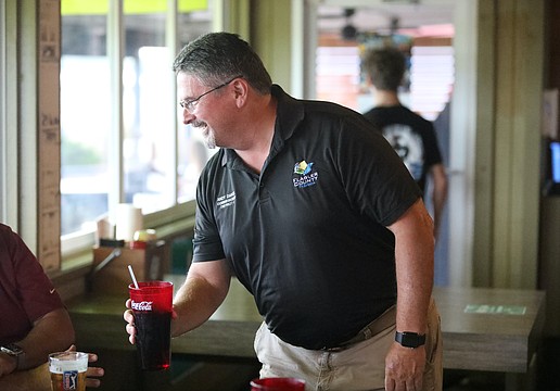
Officials serve drinks, food and conversation at Flagler County Education Foundation's VIP Service Night
April 22, 2024
Flagler Humane Society Pets of the Week for April 22
April 22, 2024
Doughnuts all day long at Ormond Beach PAL's seventh-annual Donut Dash 5K
April 22, 2024
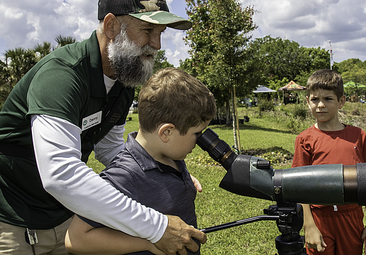
Free trees: Ormond Beach Environmental Discovery Center celebrates Earth Day
April 20, 2024
Salvadore Dalí visits Sigmund Freud in City Repertory Theatre's production of 'Hysteria'
April 19, 2024
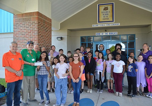
Belle Terre Elementary School K-Kids raise $550 toward Safe Haven Baby Box
April 18, 2024
Palm Coast's Alisa Sambolin serves aboard the Navy's newest aircraft carrier
April 18, 2024
Heart & Sole: Ira & Son Shoe Repair, 'the original recyclers' relocate
April 18, 2024
Flagler County Veteran of the Week: Timothy Hellmuth
April 18, 2024
Events Calendar: Celebrate Earth Day and attend a Mozart concert
April 16, 2024
Fair price: Winning bid for pig is $74 a pound at Flagler County Fair and Youth Show as community helps family of injured youth
Sports
April 24, 2024
SIDELINES: Seabreeze hires new football coach; FPC, Seabreeze advance in boys tennis regionals
April 24, 2024
Mainland's Walker crushes competition to win state weightlifting championship
April 23, 2024
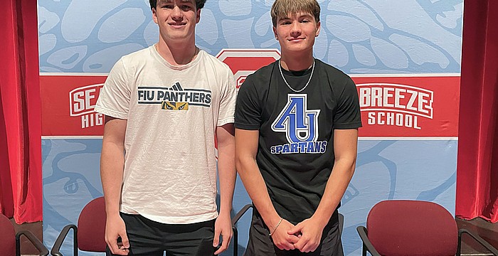
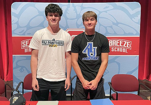
Seabreeze athletes Chandler Mitzo and Landon Smith sign to play college sports
April 22, 2024
Bringing home the hardware: Flagler Palm Coast wins Five Star Conference baseball championship
April 24, 2024
Feminine touch: The big yellow house in downtown Bunnell is now an art-centric market with nine shops, all owned by women
April 23, 2024
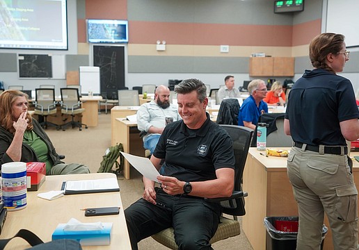
Ormond Beach city employees take part in county-wide crisis simulation training
April 23, 2024
Seabreeze athletes Chandler Mitzo and Landon Smith sign to play college sports
April 23, 2024
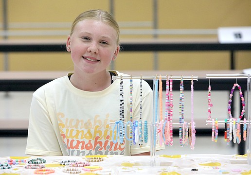
Student entrepreneurs compete in ‘the shark tank’ at Indian Trails Middle School's Kid Biz Market & Expo
April 22, 2024
Officials serve drinks, food and conversation at Flagler County Education Foundation's VIP Service Night
April 22, 2024
Bringing home the hardware: Flagler Palm Coast wins Five Star Conference baseball championship
April 22, 2024
Doughnuts all day long at Ormond Beach PAL's seventh-annual Donut Dash 5K
April 22, 2024
Free trees: Ormond Beach Environmental Discovery Center celebrates Earth Day
April 21, 2024
Flagler Palm Coast softball team rocks DeLand on senior night
April 21, 2024
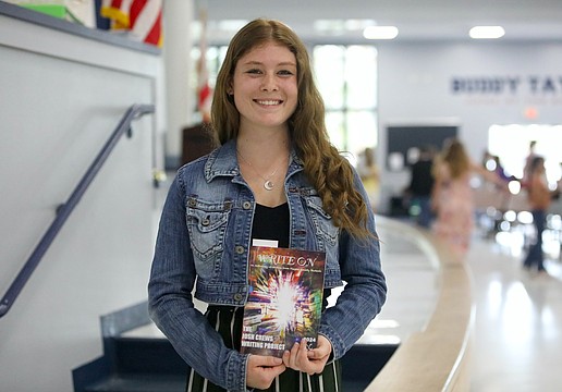
Josh Crews Writing Project Book Launch celebrates over 100 Flagler County student-authors
April 18, 2024
Heart & Sole: Ira & Son Shoe Repair, 'the original recyclers' relocate
April 17, 2024
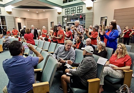
Tomoka Oaks golf course rezoning unanimously denied by Ormond Beach Commission
April 16, 2024
Furey of the Pirates: Matanzas edges Flagler Palm Coast 8-7 for its first boys lacrosse district tournament win in three years.
April 16, 2024
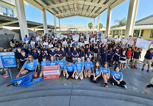
Imagine School hosts pep rally as Electro-Lions head to international championship
April 16, 2024
Fair price: Winning bid for pig is $74 a pound at Flagler County Fair and Youth Show as community helps family of injured youth
April 15, 2024
Antonio Amaral Foundation presents $30,000 in scholarships to local Portuguese students
April 15, 2024
Victory dance: Mainland holds off Seabreeze to win district flag football championship
April 13, 2024
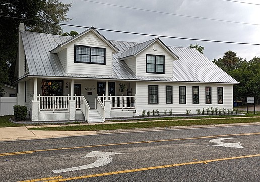
25 years in the making: Palm Coast United Methodist Church hosts grand opening
April 12, 2024
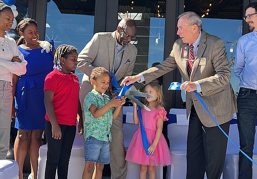
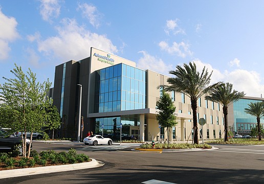
$45.7 million investment: AdventHealth Daytona Beach celebrates opening of new surgical center
April 12, 2024
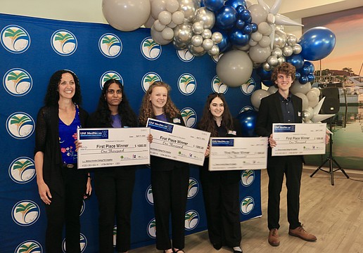
Stanton Preparatory team wins 2024 MedNexus Innovation Challenge, Matanzas students take second
April 12, 2024
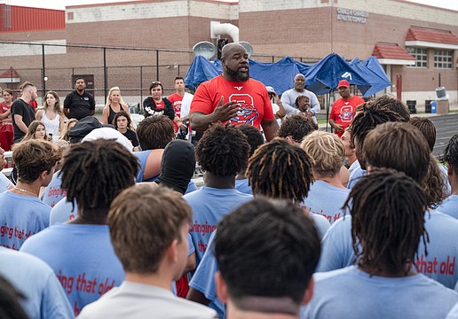
Seabreeze football coach Lester Davis resigns to join Travis Roland's staff in Georgia